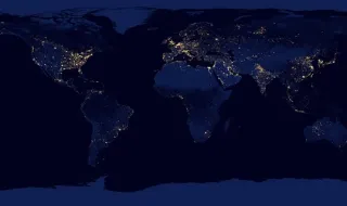
The United Nations General Assembly approved a resolution presented by Togo and supported by the African Union, which proposes the adoption of a more accurate representation on maps of the land areas of the continents, with emphasis on Africa. The objective is to correct historical distortions in the cartographic representation of the African continent and other territories.
The vote revealed a broad international consensus, with only the United States voting against the resolution. No other country or bloc opposed the measure, demonstrating the widespread recognition of the need for greater accuracy in world cartography.
The central issue of the resolution relates to the fact that traditional maps, predominantly created from Eurocentric projections, significantly distort the relative size of the continents. Africa, in particular, appears systematically smaller than it actually is in relation to other land masses, which the resolution aims to correct.