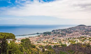
The ECMWF model maps forecast an atmospheric blocking trend for the second half of SeptemberPhoto by Lara Jameson on Pexels
Weather
Инвестиции
Санкции
Leiria

The ECMWF model maps forecast an atmospheric blocking trend for the second half of September

Meteored Portugal5 September 2026 at 07:04

The sub-seasonal projections from the European ECMWF model indicate a higher probability of the Atlantic Ridge regime establishing in the second half of September, an atmospheric blocking configuration that could significantly affect the North Atlantic. This weather pattern suggests that the Atlantic Ocean could become "closed" to storms during the first days of the second half of the month, with high pressures dominating much of the region.

In Portugal, this atmospheric blocking could translate into more stable, dry weather and above-average temperatures for the time of year. The influence of the Atlantic Ridge tends to favor milder meteorological conditions without significant precipitation during this period.

The Atlantic Ridge phenomenon represents a relatively persistent atmospheric configuration that blocks the passage of low-pressure systems coming from the Atlantic, creating prolonged stable conditions in the European region.

Related articles

Weather

Going to Rock in Rio? Bring a raincoat; forecast for the weekend is unstable weather and intense winds

Those going to Rock in Rio this weekend should bring a raincoat, as the forecast is for unstable weather and intense winds. According to the Alerta Rio system, from the city hall, on Saturday, when Avenged Sevenfold, Sepultura, Bad Omens and Black Pantera perform, the combination of areas of instability with a cold front will bring cloudy skies, light rain in the early morning and isolated light to moderate rain from the morning onwards, with weak to moderate winds. On Sunday, when Calvin Harris, Black Eyed Peas, Ne-Yo and Jota Quest perform, the scenario will be similar.

oglobo05/09/26, 08:30
Portugal prepara-se para uma tarde de trovoadas: Instabilidade do tempo aumenta este sábado
Weather

Portugal prepares for an afternoon of thunderstorms: Weather instability increases this Saturday

Continental Portugal expects a significant change in weather this Saturday, with the return of atmospheric instability and the possibility of thunderstorms in several regions of the country.

SAPO Notícias05/09/26, 08:15
Poucas nuvens e vento moderado previstos para a Madeira
Weather

Few clouds and moderate wind forecast for Madeira

The Portuguese Institute for the Sea and Atmosphere (IPMA) forecasts for Madeira generally partly cloudy skies, with light to moderate north wind, with speeds between 10 and 30 km/h.

SAPO Notícias05/09/26, 08:10
Weather

Weekend marked by strong instability: thunderstorms intensify in the North and Centre from Saturday afternoon

Mainland Portugal faces a weekend of strong atmospheric instability, with intense thunderstorms forecast for the North and Centre regions from Saturday afternoon (starting at 3pm), caused by the thermal contrast between extreme heat at the surface and a cold air mass at altitude, which enhances the formation of convective cells with heavy rainfall, lightning and possible hail. Simultaneously, 14 districts remain under yellow warning due to high temperatures, with maximums ranging between 27°C on the coast and 38°C in the Alentejo. However, the storm episode will be short-lived, with substantial improvement expected by Sunday, when the sky will clear and temperatures will drop generally, especially on the coastal strip.

oRegiões05/09/26, 08:00