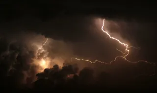
Mainland Portugal faces a Saturday of strong atmospheric instability, with the return of thunderstorms and sometimes heavy rain in the North and Centre regions. According to ECMWF model forecasts, the worsening of the weather should intensify from 3pm, lasting until 6pm, although the first convective nuclei may begin to form around 1pm in the Centre region.
This phenomenon results from the marked contrast between high surface temperatures and the arrival of a cold air mass in the upper layers of the atmosphere. This thermal discrepancy enhances the development of rapid upward movements and the formation of convective cells responsible for heavy rainfall, lightning and possible hail.
Despite the approaching storms, intense heat remains across most of the country. IPMA placed 14 districts under yellow warning due to high temperatures, with maximums ranging between 27°C in coastal cities such as Viana do Castelo and Aveiro, and 38°C expected in the Alentejo, in Évora and Beja.
For Sunday, a substantial improvement in the weather is forecast, with generally clear skies and an overall drop in temperatures, particularly along the coastal strip of the North and Centre, where maximums should be around 21°C. In the southern interior, Beja and Évora will continue to record high temperatures, with 37°C.