Change in atmospheric circulation: here are the effects in Portugal in the week between August 31 and September 4Photo by Emílio on Pexels
WeatherLeiria

Change in atmospheric circulation: here are the effects in Portugal in the week between August 31 and September 4

Meteored Portugal30 August 2026 at 17:17

In the first days of September, mainland Portugal will have wind and more moderate temperatures along the coast, due to north and northwest circulation. From Wednesday, a sharp rise in temperatures is expected, with maximums that could reach 40°C, as a result of the strengthening of an anticyclonic ridge that will allow the entry of warmer air.

The beginning of September will be marked by a gradual change in weather conditions in mainland Portugal. Maritime influence will continue to be felt in the coastal regions of the North and Centre, where cloud cover will be more frequent on Monday and Tuesday, keeping the coast cooler and windyer until Tuesday.

The warming will be more pronounced in the interior of the country, but will also be noticeable along the coast. This change in atmospheric circulation will bring a significant contrast between the conditions at the beginning of the week and the intense heat expected from Wednesday onwards.
Related articles

Último dia de Agosto traz alguma nebulosidade para a Madeira
Weather

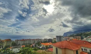
Last day of August brings some cloudiness to Madeira

The Portuguese Institute for the Sea and Atmosphere (IPMA) forecasts for today, the last day of August, generally very cloudy skies in Madeira, with gradual decrease in cloudiness from mid-morning, especially on the south side. Light rain or showers are expected until the end of the morning, mainly on the north side and highlands. Wind will blow weak to moderate (10 to 30 km/h) from the northeast, sometimes strong (up to 40 km/h) at the extremes.

dnoticias.pt30/08/26, 18:46
Após dias amenos, calor volta volta com força
Weather

After mild days, heat returns with force

After a few days with mild temperatures, the heat returns with intensity to Portugal. According to the forecast from the Portuguese Institute for the Sea and Atmosphere (IPMA), the wind will blow weak to moderate during this period of the heat's return.

SAPO Notícias30/08/26, 16:44
Weather

Dust devil lifts ashes left by summer fires

A dust devil was recorded this afternoon in the area of Seara Velha and Soutelo, in the municipality of Chaves, lifting ashes left by the forest fires that affected the region during the summer. The meteorological phenomenon, although common in conditions of heat and dry soil, drew the attention of local residents by transporting the ashes from the fires that devastated the area in the previous months.

Notícias de Coimbra30/08/26, 16:21
Weather

Rain and strong winds up to 60 km/h will remain in Portugal today and these will be the most affected regions

The last Monday of August in Portugal will be marked by distinct weather conditions between the mainland and the Azores. On the mainland, the sky will be partly cloudy or clear, with the possibility of morning fog in the North and Central regions, but wind gusts may reach 60 km/h on the west coast and in the highlands. In the Azores, precipitation will affect the three island groups differently throughout the day: showers in the early morning in the Eastern Group, light rain in the early morning and late afternoon in the Central Group, and rain during the afternoon in the Western Group, with winds between 10 and 30 km/h.

Postal do Algarve30/08/26, 16:00